Difference between revisions of "Portal:GCDAMP Gallery"
From Glen Canyon Dam AMP
(addMAP USGS Sandbar Monitoring in the Grand Canyon 150603.jpg) |
Cellsworth (Talk | contribs) |
||
| Line 1: | Line 1: | ||
| − | |||
| − | |||
| − | |||
| − | |||
| − | |||
| − | |||
| − | |||
== [[GCDAMP PHOTO GALLERY|General GCDAMP PHOTO GALLERY-LINK]] == | == [[GCDAMP PHOTO GALLERY|General GCDAMP PHOTO GALLERY-LINK]] == | ||
| + | |||
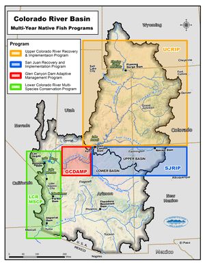
| + | [[File:GCDAMP CRBasin 20141201.jpg|thumb|left|300px]] | ||
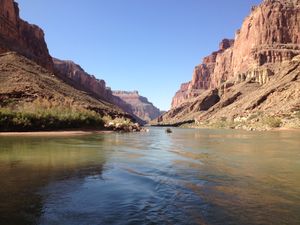
| + | [[File:120918 Natal Origins 001 Gallery.JPG|thumb|left|300px]] | ||
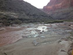
| + | [[File:120918 Natal Origins 002 Gallery.JPG|thumb|right|250px]] | ||
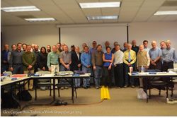
| + | [[File:2013-01 TWG Pics.jpg|thumb|right|250px]]|[[File:140130 TWG 2014- Vineetha.jpg|thumb|250px]] | ||
| + | [[File:2013-05-31 Nankoweap granaries.JPG|thumb|250px]] | ||
| + | [[File:2012-08-30 Lee Ferry tie off - group.JPG|thumb|250px]] | ||
== '''2015''' == | == '''2015''' == | ||
| Line 42: | Line 42: | ||
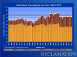
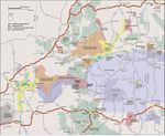
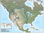
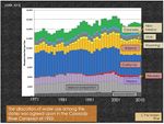
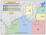
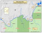
[[File:MAP USGS Sandbar Monitoring in the Grand Canyon 150603.jpg|150px]]|[[File: MAP- CR Basin with Location indicators.jpg|100px]][[File:Altered Flow Regime- USGS.jpg|150px]][[File:Lower Basin Consumptive Use- USBR Graph - 1964 too 2012.jpg|150px]][[File:NPS- Grand Canyon comprehensive- MAP.jpg|150px]][[File:MAP- North America - Major Rivers.jpg|150px|Major Rivers of North America]]|[[File:GRAPH- River alocation by entitiy and year USBR 2012.jpg|150px]]|[[File:GRAPH- GCD levels.jpg |250px]]|[[File:Strong turbidity gradient Slide 15.jpg|150px]]|[[File:Thermal Profiles in Lake Powell- Graph.jpg|150px]]|>[[File:MAP- Reservations- Parks- Monuments.jpg|150px]]|[[File:MAP-GCDAMP 20140730.jpg |150px]]|[[File:MAP-GCDAMP Alternative 20140808.jpg |150px]]</ | [[File:MAP USGS Sandbar Monitoring in the Grand Canyon 150603.jpg|150px]]|[[File: MAP- CR Basin with Location indicators.jpg|100px]][[File:Altered Flow Regime- USGS.jpg|150px]][[File:Lower Basin Consumptive Use- USBR Graph - 1964 too 2012.jpg|150px]][[File:NPS- Grand Canyon comprehensive- MAP.jpg|150px]][[File:MAP- North America - Major Rivers.jpg|150px|Major Rivers of North America]]|[[File:GRAPH- River alocation by entitiy and year USBR 2012.jpg|150px]]|[[File:GRAPH- GCD levels.jpg |250px]]|[[File:Strong turbidity gradient Slide 15.jpg|150px]]|[[File:Thermal Profiles in Lake Powell- Graph.jpg|150px]]|>[[File:MAP- Reservations- Parks- Monuments.jpg|150px]]|[[File:MAP-GCDAMP 20140730.jpg |150px]]|[[File:MAP-GCDAMP Alternative 20140808.jpg |150px]]</ | ||
| + | ---- | ||
| + | == VIDEO GALLERY == | ||
| − | --- | + | *<Span>[[File:140508 USGS-YouTube Citizen Science in Grand Canyon.jpg|200px]] |[http://www.youtube.com/watch?v=2TxLWlrw7y4&list=UUeXH8GZyV3sVqAr45AvupOA]|[[File:PIC- azgf video on Quagga.jpg|150px]] |[http://www.youtube.com/watch?v=hyqsSMJFk5c]|[[File:PIC- azgf and better shot at survival clip.jpg|150px]]|[http://www.youtube.com/watch?v=JJQVwN2AGXQ]|[[File:Challenged- but unbroken- CRWUA- PIC.jpg|200px]] |[http://www.youtube.com/watch?v=g5-E6vdPtlQ] |
| − | + | ||
| − | + | </Span> *<Span> | |
| − | + | [[File:Vermillion Video- Fishing.jpg|200px]] |[http://vimeo.com/76818138] |[[File:Hydropower 101- DOI- PIC.jpg|200px]]| [https://www.youtube.com/watch?v=tpigNNTQix8] | |
| − | + | ||
| − | + | </Span> <Span> | |
| − | <Span>[[File:121109 HFE part of adaptiely manageing GC- Anne Castle.jpg|Thumb|150px]] [http://www.usbr.gov/uc/rm/gcdHFE/2012/video/index.html | + | |
| − | <Span>[[File:LCR- AZ Game and Fish- PIC.jpg|Thumb|150px]] [http://www.youtube.com/watch?v=qaLyk5A6beU&feature=share&list=UUASn7tMQBJvzAnOQ3yHoBWw | + | [[File:121109 HFE part of adaptiely manageing GC- Anne Castle.jpg|Thumb|150px]] [http://www.usbr.gov/uc/rm/gcdHFE/2012/video/index.html] |
| + | |||
| + | </Span> <Span> | ||
| + | |||
| + | [[File:LCR- AZ Game and Fish- PIC.jpg|Thumb|150px]] [http://www.youtube.com/watch?v=qaLyk5A6beU&feature=share&list=UUASn7tMQBJvzAnOQ3yHoBWw]|*[[File:Paria River Flash Flood-Debris You Tube (1).jpg|150px]][https://www.youtube.com/watch?v=iAw_zIg9BqI '''Paria River Flash Flood- Debris Video''']| '''[[Media:Quaggas Pipe 2013.mp4| Quagga Pipe 2013-Video Clip- Courtesy of Salt River Project]]''' | ||
| + | |||
| + | </Span> | ||
| − | **VIDEO: AZGFD monitoring in the Little Colorado River: [http://www.youtube.com/watch?v=qaLyk5A6beU&feature=share&list=UUASn7tMQBJvzAnOQ3yHoBWw | + | **VIDEO: AZGFD monitoring in the Little Colorado River: [http://www.youtube.com/watch?v=qaLyk5A6beU&feature=share&list=UUASn7tMQBJvzAnOQ3yHoBWw] |
| − | *[http://www.azcentral.com/video/2180647858001 ''' | + | *[http://www.azcentral.com/video/2180647858001 '''National Park Service attempts to undo trout damage at Grand Canyon'''] |
*[http://youtu.be/kNmtWUBYf0s AZGF video of 2012’s HFE] | *[http://youtu.be/kNmtWUBYf0s AZGF video of 2012’s HFE] | ||
*'''[http://www.usbr.gov/power/video/ USBR-- Hydropower Video - Hydropower]''' is a renewable and reliable resource providing clean energy to the western United States. It is the nation's largest renewable energy resource and the Bureau of Reclamation is the second largest producer in the United States. Watch the new Reclamation video on hydropower. | *'''[http://www.usbr.gov/power/video/ USBR-- Hydropower Video - Hydropower]''' is a renewable and reliable resource providing clean energy to the western United States. It is the nation's largest renewable energy resource and the Bureau of Reclamation is the second largest producer in the United States. Watch the new Reclamation video on hydropower. | ||
*'''[http://www.usbr.gov/lc/region/programs/crbstudy/video1/index.html USBR--Colorado River Basin Study Overview Video]''' - In this brief video, Basin Study Project Manager Terry Fulp presents a snapshot of the Study's goals and progress, and invites public participation in the activities. | *'''[http://www.usbr.gov/lc/region/programs/crbstudy/video1/index.html USBR--Colorado River Basin Study Overview Video]''' - In this brief video, Basin Study Project Manager Terry Fulp presents a snapshot of the Study's goals and progress, and invites public participation in the activities. | ||
| − | *[[File:121119 GCD -HFE-USBR - Video Clip.jpg|Thumb|50px]] [http://www.usbr.gov/uc/rm/gcdHFE/2012/video/index.html | + | *[[File:121119 GCD -HFE-USBR - Video Clip.jpg|Thumb|50px]] [http://www.usbr.gov/uc/rm/gcdHFE/2012/video/index.html] |
| − | *[[File:2012 HFE -PIC.jpg|Thumb|50px]] [http://youtu.be/kNmtWUBYf0s | + | *[[File:2012 HFE -PIC.jpg|Thumb|50px]] [http://youtu.be/kNmtWUBYf0s |
*[[File:20130413 American Rivers- Video- PIC.jpg|thumb|50px]] [http://www.youtube.com/watch?v=mqYcC7jEe44&list=PLlRq94-Jr0rd8K-bIzotRRqaHfhEpmxGq&index=1] | *[[File:20130413 American Rivers- Video- PIC.jpg|thumb|50px]] [http://www.youtube.com/watch?v=mqYcC7jEe44&list=PLlRq94-Jr0rd8K-bIzotRRqaHfhEpmxGq&index=1] | ||
April 16, 2013_ American Rivers_Colorado River - America's Most Endangered River 2013 | April 16, 2013_ American Rivers_Colorado River - America's Most Endangered River 2013 | ||
Revision as of 16:00, 27 July 2016
Contents
General GCDAMP PHOTO GALLERY-LINK
|2015
2014
- 141217_Picture Uploads- Navajo Science Monitoring Trip- 2014
- 140529_Picture Uploads- Zuni monitoring trip in May 2014
- 140927_Picture Uploads- 50 Year Power Generation
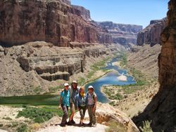
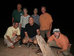
- 140920_Picture Uploads- Natal Fish Origins Science Trip-JThiriot
- 140827_Picture Uploads- AMWG
- 140305_Picture Uploads- GCNRA and ADWR
- 140214 Picture Uploads- PICS- Anne Castle
2013
- 131207_Grand Canyon-Hoover Dam- Lake Mead- Overflight PICS- JThiriot
- 130808_LTEMP-SDM Flagstaff- Pics
- 130726_Natal Origins and Juvenile Humpback Chub science trip- Craig Ellsworth
- 130221_AMWG Field Learning- CAP
2012
- 121119_HFE Event
- 120831_AMWG Field Learning
- 120831_AMWG Field Learning- Jason Pics
- 120921_Natal Fish Origins- Pics
MAPS & DIAGRAMS
VIDEO GALLERY
*
 [8]|*
[8]|* Paria River Flash Flood- Debris Video| Quagga Pipe 2013-Video Clip- Courtesy of Salt River Project
- VIDEO: AZGFD monitoring in the Little Colorado River: [9]
- National Park Service attempts to undo trout damage at Grand Canyon
- AZGF video of 2012’s HFE
- USBR-- Hydropower Video - Hydropower is a renewable and reliable resource providing clean energy to the western United States. It is the nation's largest renewable energy resource and the Bureau of Reclamation is the second largest producer in the United States. Watch the new Reclamation video on hydropower.
- USBR--Colorado River Basin Study Overview Video - In this brief video, Basin Study Project Manager Terry Fulp presents a snapshot of the Study's goals and progress, and invites public participation in the activities.
 [10]
[10] [http://youtu.be/kNmtWUBYf0s
- [11]
April 16, 2013_ American Rivers_Colorado River - America's Most Endangered River 2013
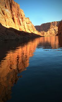
- The Colorado River's Invasive Species -CAP Video
- NPS-Resource Management Short Film-Glen Canyon National Recreation Area
- National Geographic- Change the Course Video Clip
- From: Jan Balsom (NPS)
- Date: Dec 16, 2013
- Episode I: NPS Grand Canyon Video- New Waters-Episode I
- Episode II: NPS Grand Canyon Video- New Waters-Episode II
- YIR 2014
