Difference between revisions of "Portal:GCDAMP Gallery"
From Glen Canyon Dam AMP
Cellsworth (Talk | contribs) |
Cellsworth (Talk | contribs) |
||
| Line 58: | Line 58: | ||
*[https://www.youtube.com/watch?v=R9I6D_PdTTs NPS: 2010 Humpback Chub Translocation to Shinumo Creek] | *[https://www.youtube.com/watch?v=R9I6D_PdTTs NPS: 2010 Humpback Chub Translocation to Shinumo Creek] | ||
*[https://www.youtube.com/watch?v=jVOJYD_tdyE Helicopter delivers 300 endangered humpback chub to Shinumo creek in Grand Canyon] | *[https://www.youtube.com/watch?v=jVOJYD_tdyE Helicopter delivers 300 endangered humpback chub to Shinumo creek in Grand Canyon] | ||
| − | |||
---- | ---- | ||
| Line 81: | Line 80: | ||
*[http://youtu.be/kNmtWUBYf0s AZGF video of 2012’s HFE] | *[http://youtu.be/kNmtWUBYf0s AZGF video of 2012’s HFE] | ||
*[http://www.usbr.gov/power/video/ USBR-- Hydropower Video] | *[http://www.usbr.gov/power/video/ USBR-- Hydropower Video] | ||
| + | *[https://www.youtube.com/watch?v=HlIueeNnnOU&feature=youtu.be Hydropower: What is a Black Start?] | ||
*[http://www.usbr.gov/lc/region/programs/crbstudy/video1/index.html USBR--Colorado River Basin Study Overview Video] | *[http://www.usbr.gov/lc/region/programs/crbstudy/video1/index.html USBR--Colorado River Basin Study Overview Video] | ||
*[[File:20130413 American Rivers- Video- PIC.jpg|thumb|50px]] [http://www.youtube.com/watch?v=mqYcC7jEe44&list=PLlRq94-Jr0rd8K-bIzotRRqaHfhEpmxGq&index=1 April 16, 2013_ American Rivers_Colorado River - America's Most Endangered River 2013] | *[[File:20130413 American Rivers- Video- PIC.jpg|thumb|50px]] [http://www.youtube.com/watch?v=mqYcC7jEe44&list=PLlRq94-Jr0rd8K-bIzotRRqaHfhEpmxGq&index=1 April 16, 2013_ American Rivers_Colorado River - America's Most Endangered River 2013] | ||
Revision as of 18:08, 2 October 2017
Contents
General GCDAMP PHOTO GALLERY
|2015
2014
- 141217_Picture Uploads- Navajo Science Monitoring Trip- 2014
- 140529_Picture Uploads- Zuni monitoring trip in May 2014
- 140927_Picture Uploads- 50 Year Power Generation
- 140920_Picture Uploads- Natal Fish Origins Science Trip-JThiriot
- 140827_Picture Uploads- AMWG
- 140305_Picture Uploads- GCNRA and ADWR
- 140214 Picture Uploads- PICS- Anne Castle
2013
- 131207_Grand Canyon-Hoover Dam- Lake Mead- Overflight PICS- JThiriot
- 130808_LTEMP-SDM Flagstaff- Pics
- 130726_Natal Origins and Juvenile Humpback Chub science trip- Craig Ellsworth
- 130221_AMWG Field Learning- CAP
2012
- 121119_HFE Event
- 120831_AMWG Field Learning
- 120831_AMWG Field Learning- Jason Pics
- 120921_Natal Fish Origins- Pics
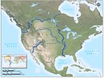
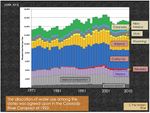
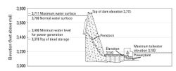
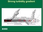
MAPS & DIAGRAMS
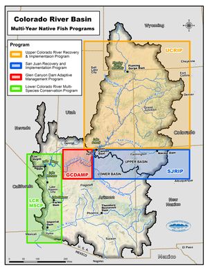
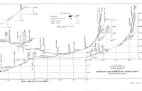
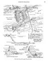
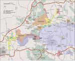
- MAPS and Diagrams Gallery
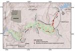
- Google map of Grand Canyon with locations of places pertinent to the GCDAMP
- LINK to Park Service maps of Grand Canyon
VIDEO GALLERY
- AZDGF: Protecting Grand Canyon's Endangered Humpback Chub, Lower 1200
- AZDGF: 2013/2014 Arizona Wildlife Views - Show 1
- AZDGF: Humpback Chub Fish
- AZDGF monitoring in the LCR: Protecting Grand Canyon's Endangered Humpback Chub
- NMSU Student Researches Humpback Chub in Grand Canyon
- USFWS: Colorado River Humpback Chub Aggregation Monitoring 2015
- USFWS: Humpback Chub Translocation in Little Colorado River 2015
- USFWS: Conservation Connect: Humpback Chub
- GCWC: Humpback Chub Translocation Grand Canyon National Park
- GCWC: Humpback Chub
- NPS: 2010 Humpback Chub Translocation to Shinumo Creek
- Helicopter delivers 300 endangered humpback chub to Shinumo creek in Grand Canyon
*
- Quagga Pipe 2013 (Courtesy of Salt River Project)
- AZGFD monitoring in the Little Colorado River
- National Park Service attempts to undo trout damage at Grand Canyon
- AZGF video of 2012’s HFE
- USBR-- Hydropower Video
- Hydropower: What is a Black Start?
- USBR--Colorado River Basin Study Overview Video
- April 16, 2013_ American Rivers_Colorado River - America's Most Endangered River 2013
- The Colorado River's Invasive Species -CAP Video
- NPS-Resource Management Short Film-Glen Canyon National Recreation Area
