Difference between revisions of "GCDAMP- Over-Flights"
Cellsworth (Talk | contribs) |
Cellsworth (Talk | contribs) |
||
| Line 83: | Line 83: | ||
|style="color:#000;"| | |style="color:#000;"| | ||
| + | *[https://www.usbr.gov/uc/progact/amp/amwg/2024-02-29-amwg-meeting/20240229-OverflightRemoteSensingSupportLong-TermMonitoringLTEMP-508-UCRO.pdf Overflight Remote Sensing in Support of Long-Term Monitoring and LTEMP ] | ||
*[https://www.usbr.gov/uc/progact/amp/twg/2024-01-25-twg-meeting/20240125-AnnualReportingMeeting-OverflightRemoteSensingSupportLong-TermMonitoringLTEMP-508-UCRO.pdf Overflight Remote Sensing in Support of Long-Term Monitoring and LTEMP ] | *[https://www.usbr.gov/uc/progact/amp/twg/2024-01-25-twg-meeting/20240125-AnnualReportingMeeting-OverflightRemoteSensingSupportLong-TermMonitoringLTEMP-508-UCRO.pdf Overflight Remote Sensing in Support of Long-Term Monitoring and LTEMP ] | ||
*[[Media:ARM2024DSMDEMPoster_IP-161668.pdf| Topographic Data from Airborne Image Acquisition of Colorado River Corridor in Grand Canyon National Park and Glen Canyon National Recreation Area: Digital Surface Models for 2002, 2009, 2013 and 2021 and Digital Elevation Model for 2021]] | *[[Media:ARM2024DSMDEMPoster_IP-161668.pdf| Topographic Data from Airborne Image Acquisition of Colorado River Corridor in Grand Canyon National Park and Glen Canyon National Recreation Area: Digital Surface Models for 2002, 2009, 2013 and 2021 and Digital Elevation Model for 2021]] | ||
Latest revision as of 10:15, 23 August 2024
|
|
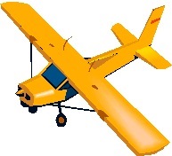
High-resolution image collection provides a rich archive of aerial imagery that is used to track changes of the Colorado River in Grand Canyon. Imagery is acquired from an airplane in Grand Canyon National Park along the Colorado River corridor and the Little Colorado River starting Memorial Day weekend and continuing through the first week of June. This imagery is used by the USGS and partners from the Glen Canyon Dam Adaptive Management Program (GCDAMP) to monitor changes in the Colorado River and riparian ecosystem in Grand Canyon and impacts of management including Glen Canyon Dam operations. Water released from Glen Canyon Dam is reduced to a steady discharge of 8,000 cubic feet per second (cfs) in the Colorado River for the duration of the image collection mission. The low river discharge is required because consistent water levels are necessary for remote sensing image analyses that compare this new image dataset to historic datasets which also were collected with constant steady discharge of 8,000 cfs. [1] |
| -- |
-- |
-- |
|---|
|
|
