Difference between revisions of "The -12 Mile Slough"
Cellsworth (Talk | contribs) |
Cellsworth (Talk | contribs) |
||
| Line 97: | Line 97: | ||
|style="color:#000;"| | |style="color:#000;"| | ||
| − | The slough is only exposed to the sun from February to November. The rest of the year the sun is behind | + | The slough is only exposed to the sun from February to November. The rest of the year the sun is behind the canyon rim. |
*November-February: no sun | *November-February: no sun | ||
*April: 4 hours | *April: 4 hours | ||
Revision as of 15:15, 1 October 2024
|
|
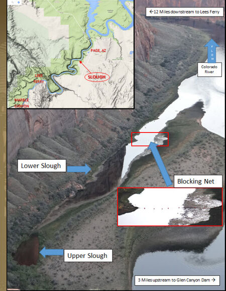
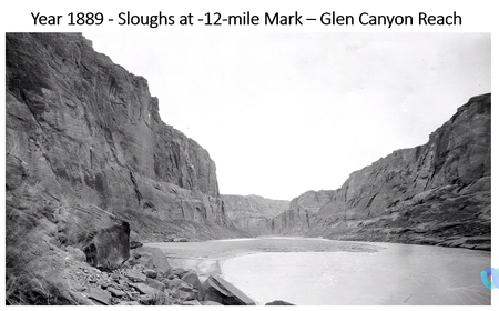
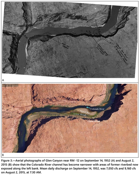
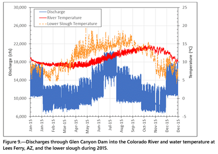
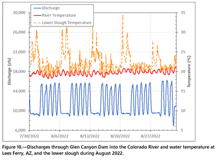
Two sloughs associated with a gravel bar that is 3.5 river miles downstream from Glen Canyon Dam or 12 river miles upstream from Lees Ferry, Arizona (AZ) (RM -12; Figure 1) are warmer than the Colorado River for much of the year creating habitat for warmwater non-native fishes. The lower (downstream) slough has a surface water connection with the Colorado River. However, the upper (upstream) slough is normally only connected with the Colorado River via groundwater through the sediments of the gravel bar (Figure 2). Darcy’s Law suggests this groundwater connection takes weeks to exchange water with the upper slough. At a river discharge of at least 20,000 cubic-feet-per-second (cfs; high end of daily fluctuating flow) water flows over the gravel bar and establishes a temporary surface water connection between the Colorado River and the upper slough. [1] |
| -- |
-- |
-- |
|---|
|
|
