Difference between revisions of "SEIS Bypass Releases"
Cellsworth (Talk | contribs) |
Cellsworth (Talk | contribs) |
||
| Line 95: | Line 95: | ||
|- | |- | ||
|style="color:#000;"| | |style="color:#000;"| | ||
| + | |||
| + | The cold-water alternatives have been modeled for cooling effects at river miles 15 and 61. Modeling | ||
| + | these locations provides a representation of potential effects on resources at different river reaches. | ||
| + | The trigger for implementation would be when observed temperatures exceed 15.5 C (60C) for 3 | ||
| + | consecutive days. Currently real time temperature data exists below Glen Canyon Dam and at Lees | ||
| + | Ferry (river mile 0). There are additional gauges at river mile 30 and river mile 61, however these | ||
| + | gages do not provide real time data, but can be downloaded remotely. For locations that do not have | ||
| + | real time temperature data, the best available models would be used to determine trigger timing. The | ||
| + | trigger location for the 15.5C (60C) threshold could be anywhere upstream of river mile 61, | ||
| + | depending on the smallmouth bass distribution and size class, frequency and efficacy of sampling, | ||
| + | or other considerations as determined through the planning and implementation process. Smallmouth | ||
| + | bass distribution upstream of river mile 61 would be assessed based on the best available | ||
| + | information and considered in the planning and implementation process, with the understanding | ||
| + | that smallmouth bass sampling is limited below Lees Ferry and can have limited efficacy in assessing | ||
| + | the locations of smaller size fish and of fish located in certain riverine environments where sampling | ||
| + | is difficult. Smallmouth bass distribution upstream of river mile 61 will be assessed based on the best | ||
| + | available information and considered in the planning and implementation process, with the | ||
| + | understanding that smallmouth bass sampling can have limited efficacy in assessing the locations of | ||
| + | smaller size fish and of fish located in certain riverine environments where sampling is difficult. [https://www.usbr.gov/uc/DocLibrary/EnvironmentalImpactStatements/GlenCanyonDamLong-TermExperimentalManagementPlan/20240703-GCDLTEMP-FinalSEIS-RecordofDecision-508-AMWD.pdf (ROD) ] | ||
| + | |||
| + | For 2024, based on the likelihood of needing to respond to increasing river temperatures, this ROD | ||
| + | provides guidance for smallmouth bass flow operations. A cool mix would occur when the average | ||
| + | daily temperature at river mile 61 exceeds 15.5 C (60 F) for 3 consecutive days. The temperature | ||
| + | data would be determined using real-time stream gage data at the dam and at Lees Ferry and existing | ||
| + | downstream models (such as Dibble et al. 2021). The Cool Mix Alterative would be implemented | ||
| + | until the mean daily water temperature (without bypass) falls below 15.5 C (60 F) at river mile 61. | ||
| + | Temperature and biological monitoring would occur throughout this process to assess effectiveness. | ||
| + | Gage data near river mile 61 would be accessed monthly during implementation to confirm | ||
| + | temperature targets are being met. [https://www.usbr.gov/uc/DocLibrary/EnvironmentalImpactStatements/GlenCanyonDamLong-TermExperimentalManagementPlan/20240703-GCDLTEMP-FinalSEIS-RecordofDecision-508-AMWD.pdf (ROD) ] | ||
| + | |||
The ROD states that in 2024, “The Cool Mix Alternative would be implemented until the mean daily water temperature (without bypass) falls below 15.5°C (60°F) at river mile 61.” Furthermore, it states that in any given year for each alternative, “The trigger location for the 15.5°C (60°F) threshold could be anywhere upstream of river mile 61, depending on the smallmouth bass distribution and size class, frequency and efficacy of sampling, or other considerations as determined through the planning and implementation process.” [[Media:2024_SMB_Flow_Offramp_-_Decision_Memo.pdf|(2024 SMB Flow Offramp - Decision Memo)]] | The ROD states that in 2024, “The Cool Mix Alternative would be implemented until the mean daily water temperature (without bypass) falls below 15.5°C (60°F) at river mile 61.” Furthermore, it states that in any given year for each alternative, “The trigger location for the 15.5°C (60°F) threshold could be anywhere upstream of river mile 61, depending on the smallmouth bass distribution and size class, frequency and efficacy of sampling, or other considerations as determined through the planning and implementation process.” [[Media:2024_SMB_Flow_Offramp_-_Decision_Memo.pdf|(2024 SMB Flow Offramp - Decision Memo)]] | ||
| Line 102: | Line 132: | ||
|- | |- | ||
|style="color:#000;"| | |style="color:#000;"| | ||
| + | |||
| + | The Cool Mix Alterative would be implemented | ||
| + | until the mean daily water temperature (without bypass) falls below 15.5 C (60 F) at river mile 61. [https://www.usbr.gov/uc/DocLibrary/EnvironmentalImpactStatements/GlenCanyonDamLong-TermExperimentalManagementPlan/20240703-GCDLTEMP-FinalSEIS-RecordofDecision-508-AMWD.pdf (ROD) ] | ||
Potential off-ramps would be considered based on monitoring data. Off-ramps will occur if any | Potential off-ramps would be considered based on monitoring data. Off-ramps will occur if any | ||
Revision as of 16:46, 20 November 2024
|
|
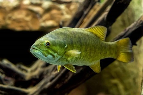
Purpose and NeedThe purpose of the 2024 LTEMP SEIS is for Reclamation to analyze additional flow options at Glen Canyon Dam in response to nonnative, invasive smallmouth bass and other warmwater, nonnative species recently detected directly below the dam. The recent detection of large numbers of young-of-year smallmouth bass suggests spawning is occurring for the first time directly below the dam. The need is to disrupt the establishment of smallmouth bass below Glen Canyon Dam by limiting additional recruitment, which could threaten populations of the threatened humpback chub below the dam. |
| -- |
-- |
-- |
|---|
|
|
