Difference between revisions of "GCDAMP Sediment"
Cellsworth (Talk | contribs) |
Cellsworth (Talk | contribs) |
||
| Line 112: | Line 112: | ||
*Proactive Spring HFEs in years with high annual water volume (i.e., ≥10 maf) in April, May, or June (the duration is limited to 24 hours) | *Proactive Spring HFEs in years with high annual water volume (i.e., ≥10 maf) in April, May, or June (the duration is limited to 24 hours) | ||
*Sediment-Triggered Fall HFEs up to 96 hours | *Sediment-Triggered Fall HFEs up to 96 hours | ||
| − | *Extended-Duration Fall HFEs up to 250 hours (the duration of the first implementation of an extended-duration HFE will be limited to no more than 192 hours) | + | *Extended-Duration Fall HFEs up to 250 hours (the duration of the first implementation of an extended-duration HFE will be limited to no more than 192 hours and there will be no more than four extended-duration fall HFEs over the 20-year LTEMP period) |
|- | |- | ||
Revision as of 17:51, 2 May 2017
|
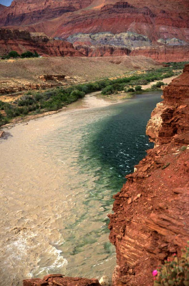
The Paria River flowing into the mainstem Colorado River |
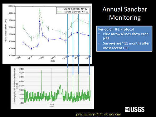
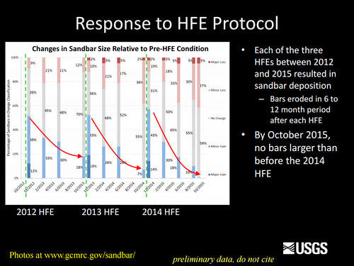
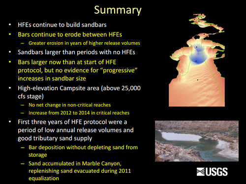
Sediment and GeomorphologyErosion of sandbars (beaches) along the Colorado River in Grand Canyon was first reported in the early 1970s, approximately 10 years after completion of Glen Canyon Dam. Since then, scientific studies have been conducted to monitor changes in sandbars and changes in the amount of sand stored on the bed of the river. One of the outcomes of these studies has been the implementation of flow experiments intended to rebuild eroded sandbars, especially by the release of controlled floods, also called High Flow Experiments, or HFEs, from Glen Canyon Dam. The sediment and geomorphology projects at Grand Canyon Monitoring and Research Center include the collection and processing of data to provide information needed to conduct controlled floods and to evaluate the outcome of each controlled flood and the long-term effects of controlled floods and normal dam operations on sediment-related resources. [1] Beginning in 1998, recreational campsite area has also been measured on a subset of the sandbar monitoring sites. Campsite areas are defined as areas that are flat (less than 8 degree slope), smooth (not rocky), and clear of dense vegetation. Monitoring data show that vegetation expansion and sandbar erosion/deposition contribute to reductions in campsite area. LTEMP Resource Goal for SedimentIncrease and retain fine sediment volume, area, and distribution in the Glen, Marble, and Grand Canyon reaches above the elevation of the average base flow for ecological, cultural, and recreational purposes. Desired Future Condition for Sediment-Related ResourcesHigh elevation open riparian sediment deposits along the Colorado River in sufficient volume, area, and distribution so as to provide habitat to sustain native biota and desired ecosystem processes |
| --- |
--- |
--- |
|---|


